Stein am Rhein Field Trial
Mar 28, 2023
Our first project field trial occurred during 20-24 March 2023 in Stein am Rhein, Switzerland. The location was a cantonal forest located right on the Swiss/German border north of the Rhine river. We were hosted by the Stein am Rhein forest works (Stefan Haab) and coordinated by the team of Holgar Griess and Janine Schweier from WSL.
The purpose of the trial was to establish standard data collection proceedures and to create reference maps of the Stein am Rhein forest for future trials.
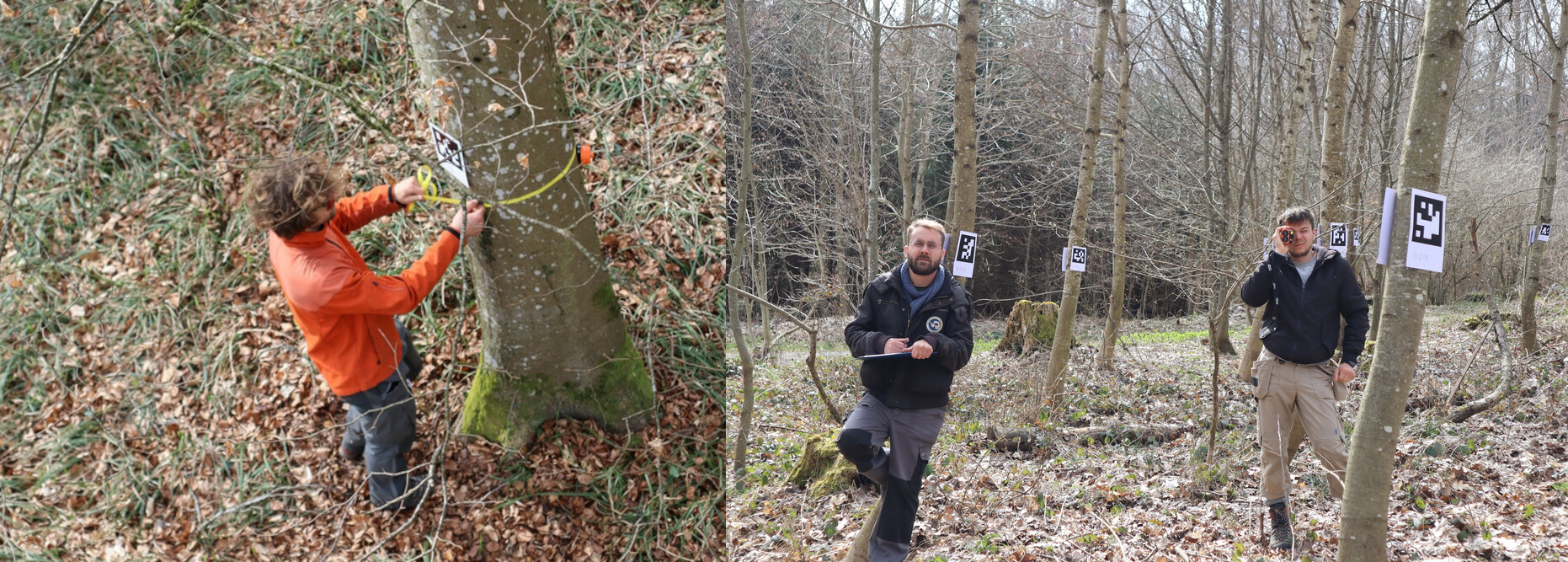
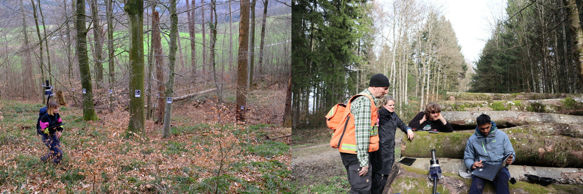
Ten 30m x 30m reference plots were measured out and manually measured by the WSL team. Branches, species, crown height and other attributes were noted.
We also attached April Tags to the trees to enable us to cross reference individual trees and to build a Geo-reference map.
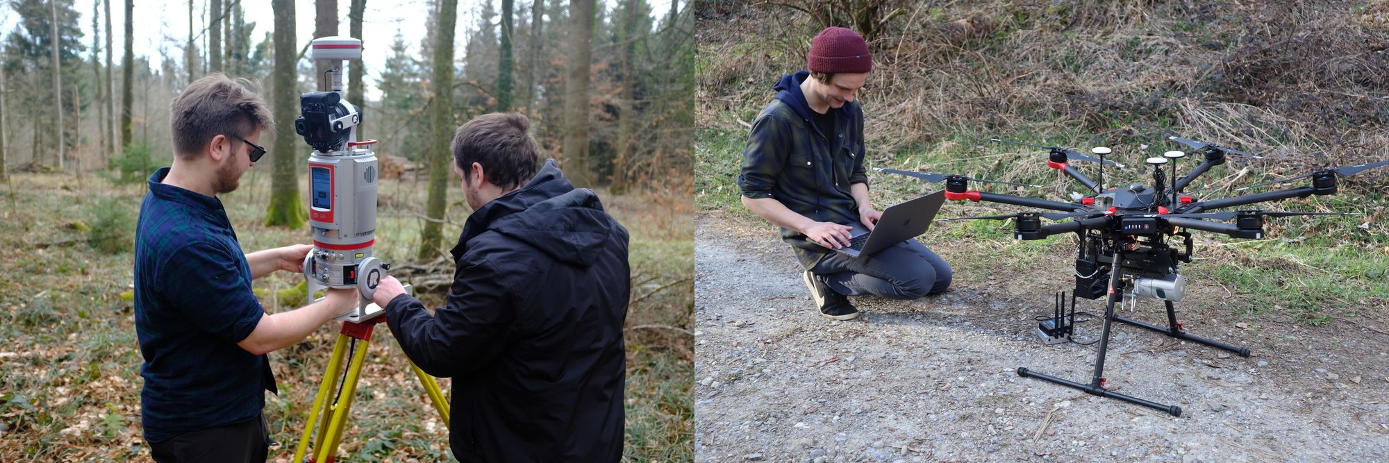
Personnel from PreFor used WSL’s Riegl terrestrial lidar scan and their own lidar mapping payload to build 3D maps. The DJI M600 drone flys above the canopy using the Swiss digital elevation model to fly above the canopies.
The Oxford team focused on mobile scanning with a self built packpack solution shown above. By walking through the forest a 3D model can be built up in real-time. University of Bonn also mapped in this manner with a handheld BLK2Go scanner from Leica.
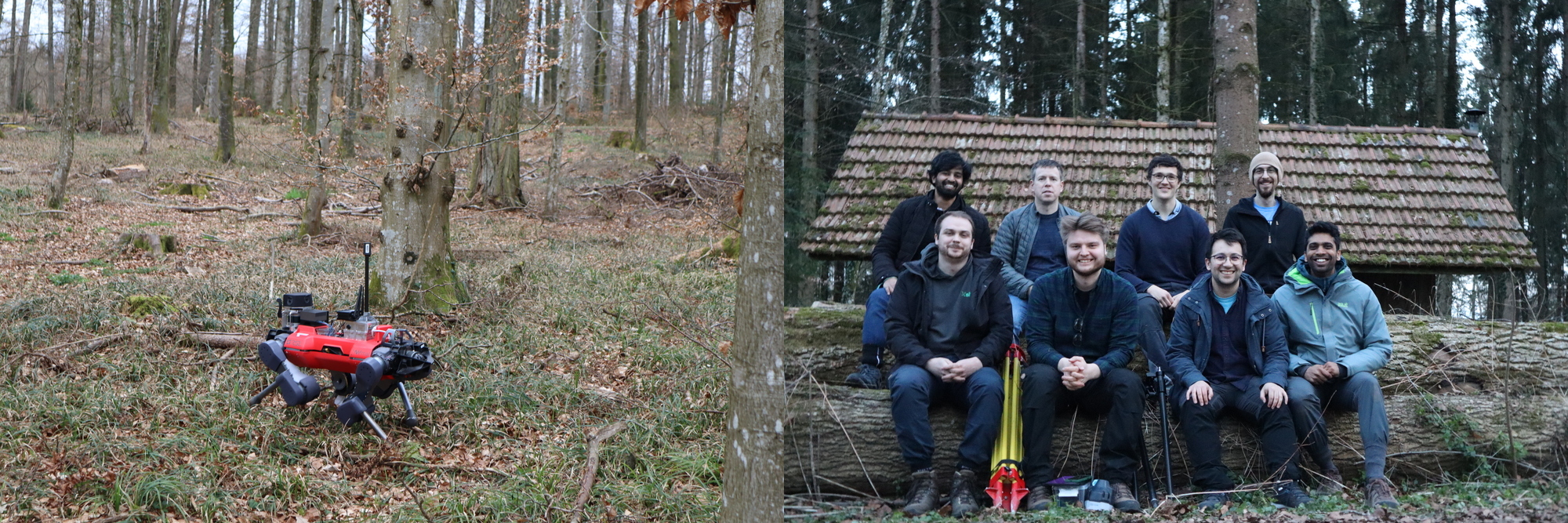
On the final day researchers from the Robot Systems Lab of ETH brought an ANYmal quadruped and tested a new algorithm for autonomous exploration with the Oxford researchers.
Our next field trial will be in rural Finland in the forests around the village of Evo, part of the HAMK Evo Forestry School, in May 2023.